Planimeter GPS Area Measure 2.1.14
Paid Version
Publisher Description
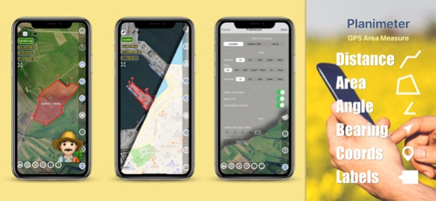
Distance, angle, bearing and area calculation, Metric | Imperial unit, open | save | share KML/CSV, Edit | Fit points, add points with Lat - Lng, GPS TRACKING, Notes
Planimeter is a tool to measure distance, area and perimeter on a map. You can measure manually or by GPS tracking. You can also check the bearing and geo-coordinates of your location and share it. Points can be labeled, saved and shared in KML format.
This measurement app is useful for outdoor activities and can be used as land surveyor by amateurs and professionals in various industries like sport, farming, landscaping, paving and construction, road building and repairing, real estate business, hiking and travel, fencing, lot building and planning, solar panel installation (roof area estimation), object mapping, lawn design, and many other where land area and distance / length calculations, land survey or maps are involved.
If you have any question about Planimeter and its functionality, please check How To Use Quick Guide:
http://ios.vistechprojects.com/Planimeter_iOS_QuickGuide.pdf
Video Demo:
http://youtu.be/unjYbPCIYM0
http://youtu.be/QQMilHVD5e8
Features:
Accurate distance and area calculation
Metric and Imperial units (m, km, feet, yards, miles, ha, acres)
Angle between lines
Bearings To and From the point
Forth and Back navigation through points by touch on Info Panel
GPS coordinates of a point
GPS accuracy settings (if GPS available)
Manage previously saved projects: open, save, share KML files
KML files created by Planimeter can be imported to GEarth and GMaps to view on a desktop
Send data by email: picture, coordinates as text message, KML file
Save KML or TXT in local storage
Map/Satellite View
Zoom and Edit points
Current location search
Text (address) search
Delete selected/last/all points
Zoom to Fit-in and center points on a screen - quick points search
Add points by touch
Add current location as a point
Show location with Latitude and Longitude coordinates
Add points by Geo-coordinates: Lat and Lng
Option to center last point added
Option to show/hide lines
Preferences: location accuracy, tracking time interval, delete points confirmation, sound option for tracking
Separate units settings for distance, area, perimeter
Target Mode for accurate pin placement
Show current coordinates in Target Mode
Stylus Draw Mode
Full-screen option
GPS TRACKING
Manual pin placement in GPS Tracking
The app has been successfully used in different areas:
- outdoor activities: sports, golf (distance between two points or holes), bike tours, trail planning, travelling, quick path measure
- garden and yard: landscape planning, grass cutting, lawn care and mowing, fencing, grass seeding.
- agriculture, poultry and farming: harvesting, fertilizing, crops (corn, wheat, maize, beet, etc.) planning and estimation, field area measure, paddocks and area fencing for cows, horses, chickens, rabbits, etc.
- solar energy: area estimation for solar panels, flat roof area estimation
- construction: land survey, road sealing, parking lot repairing
- forestry: objects and tree mapping, damage area estimation, measure land area
- other: ponds size and are measure; pole lines planning; movement tracking; get exact GPS coordinates of way-points; fence calculation; geocaching.
Note: Continued use of GPS running in the background can dramatically decrease battery life.
If you like the app and find it useful please support us with your feedback and comment.
Feel free to contact support@vistechprojects.com with any questions, comments or bug reports.
Feb 13, 2024
Version 2.1.14
- settings to hide notes in the Note mode for better pins placement
- improvements in PDF report
- stability improvements
About Planimeter GPS Area Measure
Planimeter GPS Area Measure is a paid app for iOS published in the Office Suites & Tools list of apps, part of Business.
The company that develops Planimeter GPS Area Measure is VisTech.Projects LLC. The latest version released by its developer is 2.1.14. This app was rated by 2 users of our site and has an average rating of 2.5.
To install Planimeter GPS Area Measure on your iOS device, just click the green Continue To App button above to start the installation process. The app is listed on our website since 2024-02-13 and was downloaded 153 times. We have already checked if the download link is safe, however for your own protection we recommend that you scan the downloaded app with your antivirus. Your antivirus may detect the Planimeter GPS Area Measure as malware if the download link is broken.
How to install Planimeter GPS Area Measure on your iOS device:
- Click on the Continue To App button on our website. This will redirect you to the App Store.
- Once the Planimeter GPS Area Measure is shown in the iTunes listing of your iOS device, you can start its download and installation. Tap on the GET button to the right of the app to start downloading it.
- If you are not logged-in the iOS appstore app, you'll be prompted for your your Apple ID and/or password.
- After Planimeter GPS Area Measure is downloaded, you'll see an INSTALL button to the right. Tap on it to start the actual installation of the iOS app.
- Once installation is finished you can tap on the OPEN button to start it. Its icon will also be added to your device home screen.
